“To love a place is not enough. We must find ways to heal it.”
— Robin Wall Kimmerer, Braiding Sweetgrass: Indigenous Wisdom, Scientific Knowledge, and the Teachings of Plants
The Science and Resilience Institute would like to acknowledge the Canarsie and Rockaway Lenape, “the original People,” who occupied Jamaica Bay for centuries before Europeans arrived. They called the estuary we study and the lands surrounding it Yameco, a Munsee word for beaver. It was part of the Lenapehoking, the homeland of the Lenape people where they hunted, fished, raised families, interred their ancestors, and lived in harmony with the land and waters that stretched from what is now Delaware to the lower Hudson. Waníshi, Lenape. Thank you.

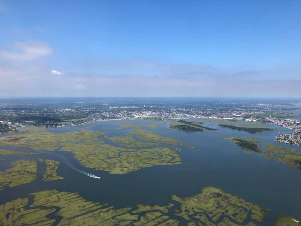
Eighteen thousand years ago, when the glaciers that covered most of the northern hemisphere at last retreated, they left in their grinding wake the beginnings of Jamaica Bay — a blue-green jewel of lagoon set in what is now New York City. Over millennia of geologic processes, it was transformed into a world of wetlands and fens, of upland forests and lowland marshes, of sand and sea. It eventually teemed with wildlife — deer, bears, cougars, squirrels, raccoons, etc., and the beaver from whom it takes its name and whose busy work helped create a landscape perfect for the birds, beasts and indigenous people who lived there before Europeans arrived.
The beavers are gone now. Much of the lands around the lagoon – and the streams that fed the estuary – are buried beneath the built world of modern humanity: streets and highways, homes and businesses, railways, and airports. Much remains, however. It has approximately 100 fish species (Trust for Public Land and NYC Audubon, 1987). Schools of menhaden (aka bunker) in the hundreds swim in its waters, hunted by the striped bass prized by local fishermen. It’s a bird watchers paradise, home to over 325 species such as the Osprey, the Barn Owl, and the Yellow-crowned Night Heron (Trust for Public Land and NYC Audubon, 1987, 1993). Many bird species use its shallow waters as a waystation in their annual migrations. Fifty butterfly species flutter in its forests and marshes. It has several species of native reptiles, amphibians, and small mammals. It even has attracted a resident seal population that recently welcomed its first native pup birth in what scientists think is over a century. Jamaica Bay is alive. It is New York City’s “rainforest” but one that includes many communities that are an important part of the estuary’s socio-ecological and economic system. These neighborhoods contain more than 3 million people, in two of the city’s most densely populated and diverse boroughs: Brooklyn and Queens.

It’s also a paradise that’s been under siege for more than 100 years. The physical-ecological-social system that is the Jamaica Bay watershed has taken thousands of years to form, with the most rapid changes in the last century. Jamaica Bay and the surrounding communities have been affected by urbanization, cycles of employment and investment, construction of major infrastructure, pollution, landfilling and dredging. All of this is set against a background of the rising effects of man-made climate change — sea level rise, intensifying coastal storms, and the loss of species diversity and habitat.
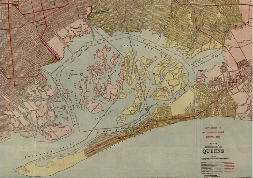
Human development in the 20th century transformed the physical and natural systems of the estuary in profound ways. Landfilling of shallows, channel dredging, and the removal of sediments from “borrow” pits have increased the volume of the bay and changed the circulation of water. The mean depth has increased from an original five feet to approximately 15 feet today (Orton et al. 2020).
A similar pace of transformation occurred along the shore. The shoreline drift that historically characterized wide variations in the location of barrier beaches such as the Rockaways has been stalled by a century of shoreline hardening. Major development projects such as Floyd Bennett Field, JFK airport, and the Belt Parkway have established high-value infrastructure along the shoreline. The interior of the watershed also was rapidly populated throughout the 20th century. Many of the freshwater and brackish creeks that drain into Jamaica Bay have been bulkheaded and channelized. Two-thirds of the freshwater runoff is now diverted through four sewage treatment facilities, which produce approximately 250million gallons of treated effluent per day (Isleib et al. 2007).
The Bay’s ecosystem diversity is at peril, as is the sustainability of its ecosystem services. Studies conducted over the last 15 years show more than a 60 percent loss in salt marshes at Jamaica Bay since the 1950s (Change Analysis, Gateway National Recreation Areas, Christiano and Mellender). There is much speculation about the causes, which are complex and include heightened nutrient inputs from sewage treatment, human changes to the channels and shoreline, sea level rise, and increased tidal range. The next century holds the promise of more profound changes, particularly as climate change and sea level rise continue to magnify the outcome of other stresses and shocks.

The central question for the region and the Institute is how to regain some of the values that have been lost, such as restoring wetlands that can help the city adapt to rising sea levels and conserving those values that remain. Part of the answer is to expand and deepen resilience practices, such as the Army Corp of Engineers’ ambitious marsh restoration projects and the Jamaica Bay-Rockaway Parks Conservancy’s West Pond Living Shoreline Restoration Project. Another part of the answer is expanding science efforts, using new methods and local knowledge that can inform how these practices are designed, monitored, and tested. These principles of drawing on science and knowledge to inform adaptive management are at the heart of the Science and Resilience Institute’s mission.
“(C)limate change is a grave and mounting threat to our wellbeing and a healthy planet. Our actions today will shape how people adapt and nature responds to increasing climate risks.” -Hoesung Lee, Chair of the United Nations Intergovernmental Panel on Climate Change (IPCC)
Blogs Related to Jamaica Bay:
Spotlight: Faculty Research
Holly Porter-Morgan: Neighborhood Flood Mapping Initiative Dr. Porter-Morgan’s current research focuses on stormwater management and resilience. Extreme weather events have become more frequent across the

SRIJB Team Co-Publishes Paper on FloodNet Project
A team representing the Science and Resilience Institute at Jamaica Bay (SRIJB), the CUNY Advanced Science Research Center, New York University, the New York City

SRIJB adds PhD student Georgie Efegenia Humphries to the team
The Science and Resilience Institute at Jamaica Bay is expanding again to meet the growing challenges the estuary faces in a changing climate. SRIJB would

SRIJB Welcomes Polly Pierone & Véronëque Ignace
As NYC faces growing threats from sea level rise, the Science and Resilience Institute at Jamaica Bay is expanding its FloodNet team. FloodNet is a
Spotlight: Faculty Research
Holly Porter-Morgan: Neighborhood Flood Mapping Initiative Dr. Porter-Morgan’s current research focuses on stormwater management and resilience. Extreme weather events have become more frequent across the
SRIJB Team Co-Publishes Paper on FloodNet Project
A team representing the Science and Resilience Institute at Jamaica Bay (SRIJB), the CUNY Advanced Science Research Center, New York University, the New York City
SRIJB adds PhD student Georgie Efegenia Humphries to the team
The Science and Resilience Institute at Jamaica Bay is expanding again to meet the growing challenges the estuary faces in a changing climate. SRIJB would
SRIJB Welcomes Polly Pierone & Véronëque Ignace
As NYC faces growing threats from sea level rise, the Science and Resilience Institute at Jamaica Bay is expanding its FloodNet team. FloodNet is a


