New Flood Sensors Capture Tidal Flood Data Around Jamaica Bay
Katie Graziano, New York Sea Grant
Recent tidal flooding around Jamaica was captured for the first time by coastal flood sensors, installed as part of a pilot project funded by the CUNY Office of Research under their Interdisciplinary Climate Crisis Research Grant program.
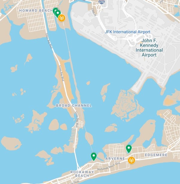
The project team included the Science and Resilience Institute at Jamaica Bay, Brooklyn College, Advanced Science Research Center, Center for the Study of Brooklyn, New York Sea Grant, and the Mayor’s Office of Climate Resiliency. We worked closely with coastal communities, specifically with the New Hamilton Beach Civic Association and the Rockaway Institute for Sustainability and Equity, to test new flood sensor technology. Five sensors are currently installed in Hamilton Beach and Far Rockaway, Queens. Two of those sensors are placed over water, to measure the rise and fall of the tides at Hawtree Basin in Hamilton Beach and Marina 59 in Far Rockaway. Three of the sensors are placed on the street, to measure the depth of floodwater at Russell St. & Davenport Ct. in Hamilton Beach and Beach 84th in Far Rockaway.
Map: Flood sensor locations in Hamilton Beach and Far Rockaway are marked by the green pins.
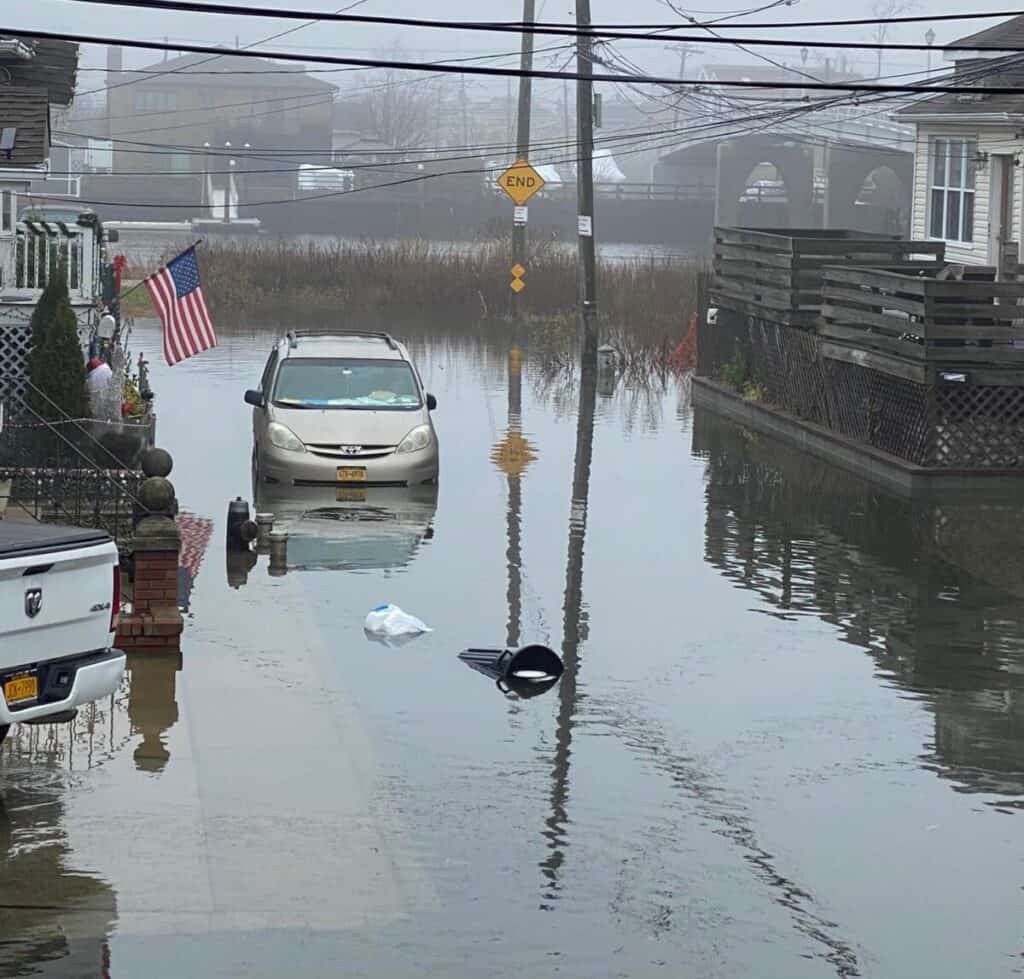
The new sensors were put to the test on December 30 through January 5th, when the New Moon made the high tides exceptionally high, combined with additional storm surge pushing the water on land. The result was almost 2 ft. of flooding on some streets around Jamaica Bay, with the deepest flooding in Rockaway on the bayside of Beach 84th Street. The plight of residents in that location even got attention in the media.
Each flood sensor can capture an impressive amount of data about the flood event, including precise depth, duration, timing and flood thresholds. These precise data, in tandem with resident flood reports submitted through the Community Flood Watch Project, can help residents, scientists and governments to better understand flood patterns and build resilience.
Flooding at Davenport Ct., New Hamilton Beach, 9:58 am 1/2/2022. One FloodNet flood sensor is located just out of the frame of this photograph. The sensor recorded 16 inches of flooding, peaking two hours before this photo was taken. Photo courtesy of Hamilton Beach HIgh Tide Photos/Community Flood Watch Project.
This work is now part of a larger, city-wide effort called ‘FloodNet’, a collaboration between our team, researchers at New York University, the Mayor’s Office of the Chief Technology Officer and the Mayor’s Office of Climate Resiliency – www.floodnet.nyc. Thanks to the success of this CUNY pilot program and our partners at NYU, NYC is interested in funding FloodNet to install 500 flood sensors across all 5 boroughs. To get in contact or suggest a location for a sensor, please visit https://www.floodnet.nyc/contact-us/.